KATHMANDU: Although the monsoon entered Nepal 15 days earlier than average on May 29 through Koshi Province, it has since retreated back toward East Asia, leaving the rest of the country dry.
According to meteorologist Govinda Jha from the Department of Hydrology and Meteorology, the monsoonal winds, which typically enter from the Bay of Bengal, have been diverted eastward—primarily toward the Philippines—due to a strong low-pressure system in the region. As a result, monsoon conditions failed to spread beyond Koshi.
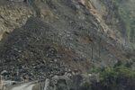
The brief presence of the monsoon brought heavy rain and flooding in eastern Nepal on May 31. Flash floods swept away 100 meters of the Dharan–Dhankuta road section in Sangurigadhi Rural Municipality-6 and submerged 22 houses in Jhapa after the Mai River overflowed. Since then, no significant rainfall has occurred.
While local and westerly winds remain active over western and central Nepal, they have not been sufficient to usher in monsoon conditions.
Meteorologist Jha explained that the Bay of Bengal system is currently weak, contributing to rising temperatures across the country. The break in the monsoon pattern, experts say, is concerning. It could bring excessive rainfall in some regions and drought in others.
However, hope remains. Another low-pressure system is forming in the Bay of Bengal, and central India is also experiencing developing low-pressure zones. These could potentially push rain-bearing clouds toward Nepal starting tomorrow. The Department of Hydrology and Meteorology has already forecasted above-average rainfall and higher temperatures this year.
In response, the National Disaster Risk Reduction and Management Authority (NDRRMA) has activated its preparedness plan. According to spokesperson Ram Bahadur KC, nearly 2 million people could be affected by this year’s monsoon, with up to 10 percent potentially requiring rescue and relief support.


Comment