




KATHMANDU: The wounds left by the devastating Bhotekoshi flood of August 26 have yet to heal. Rescue, relief and rehabilitation efforts are still underway across Rasuwa, Nuwakot and the Trishuli Corridor, while roads, bridges, hydropower projects and settlements in some areas have yet to recover.
Meanwhile, another weather system is developing.
A low-pressure system formed over the northern Andaman Sea in the Bay of Bengal is moving west-northwestward. According to recent projections from the India Meteorological Department, the system could develop into a depression by September 21 and a deep depression by September 22 before reaching the coastal area of southern Odisha and northern Andhra Pradesh around September 23.
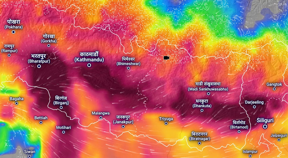
The system’s direct impact on Nepal is not yet certain. However, various weather forecast models indicate that rainfall activity in Nepal could increase significantly from September 24 to 28. Meteorologist Dr Binod Pokharel said some models have indicated more than 400 mm of rainfall in some areas, with a maximum projection of around 741 mm.
This does not mean that 741 mm of rain will fall across Nepal. It is a possible maximum indicated by some models. The amount and location of rainfall could vary significantly depending on the system’s direction, speed, strength and changes as it approaches Nepal.
Therefore, the current situation should not be understood as a confirmed major disaster, but as a period when preparations should begin for the possibility of heavy rainfall.
Why could the Bay of Bengal system bring heavy rain to Nepal?
Weather systems originating in the Bay of Bengal are not unusual in Nepal. During the monsoon, low-pressure areas and depressions formed over the Bay of Bengal carry large amounts of moisture across South Asia.
The current system is also moving west-northwestward from the northern Andaman Sea. It could gain further strength as it moves toward India. The India Meteorological Department has warned of very heavy to extremely heavy rainfall in coastal southern Odisha and northern Andhra Pradesh from September 22 to 24.
As the remnants of the system and moisture-laden air spread north and northeastward through eastern and northeastern India, conditions could develop for rainfall in Nepal.
Another important factor for Nepal is the possible interaction between westerly winds and the system originating in the Bay of Bengal. Meteorologists say rainfall could increase if the interaction between the systems becomes stronger.
The cyclone itself does not need to reach Nepal. Even if the system weakens while moving toward India, the moisture it carries and the prevailing atmospheric conditions could still produce prolonged rainfall in Nepal.
Is ‘Arnab’ already formed?
Some confusion has emerged on social media regarding the system. The system currently developing in the Bay of Bengal has not officially been named ‘Arnab’.
It is currently a low-pressure system. If it reaches the required cyclonic intensity, it will be named ‘Arnab’ according to the naming list designated for the North Indian Ocean. The name ‘Arnab’ was proposed by Bangladesh.
Therefore, rather than saying that “Cyclone Arnab is coming to Nepal,” it is scientifically more appropriate at this stage to say that a low-pressure system developing over the Bay of Bengal could affect Nepal.
Impact in India
The system’s impact is becoming comparatively clearer in India. The India Meteorological Department has forecast heavy to very heavy rainfall in southern Odisha and coastal Andhra Pradesh. An extremely heavy rainfall warning has also been issued for Odisha for September 23 and 24.
Rainfall activity is also expected to increase in West Bengal and Sikkim after September 23. West Bengal could experience heavy rainfall from September 24 to 26.
Thus, the system’s initial main area of impact is currently eastern and coastal India. Changes in its path and strength could alter the areas affected.
Bangladesh also monitoring the system
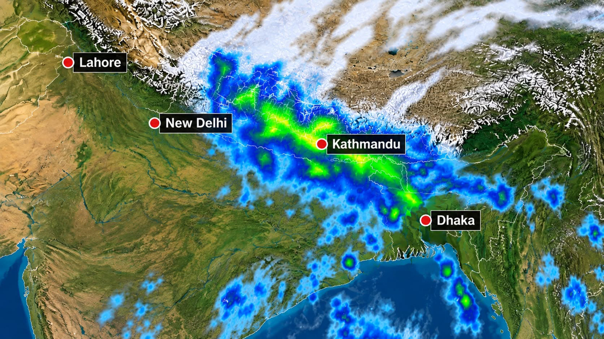
The Bay of Bengal system is also significant for Bangladesh. The Bangladesh Meteorological Department had earlier forecast the formation of a low-pressure area over the Bay of Bengal around September 19 and warned of heavy rainfall and temporary strong winds in various parts of the country.
However, as current projections indicate that the system will move toward southern Odisha and northern Andhra Pradesh, its initial main impact is expected in those areas of India. Any change in its direction could alter the risk for Bangladesh and West Bengal.
Risks in Nepal
If heavy rainfall occurs in Nepal, its impact will not be limited to rainfall alone.
The end of the monsoon season is particularly sensitive. In many areas, the soil is already saturated after prolonged rainfall. Additional heavy rainfall within a short period could cause rivers and streams to rise rapidly, trigger landslides and block roads.
Landslides and soil erosion: The severe rainfall of September 26, 2024 remains fresh in people’s memories. That year, heavy rainfall caused major damage in Kathmandu, Kavrepalanchok, Lalitpur, Bhaktapur and Sindhuli. Streams in Kathmandu Valley rose suddenly, while around 10 kilometres of the BP Highway in Sindhuli and Kavre were destroyed.
A similar risk of heavy rainfall is being projected this September. With rainfall continuing since Ashadh, the soil has become saturated in many areas. Prolonged rainfall in hilly and mountainous regions could increase the risk of landslides, particularly on slopes already weakened by previous landslides.
Flash floods: Water levels in small and large streams could rise rapidly. Settlements along rivers and in narrow gorges could face sudden flooding.
Rising river levels: Heavy rainfall in upper watersheds could increase flows downstream in river systems including the Bhotekoshi, Trishuli, Karnali, Narayani and Koshi.
Road and transport disruption: Landslides and floods could block highways and rural roads, making long-distance travel risky.
Urban flooding: In Kathmandu Valley and other major cities, intense rainfall over a short period could overwhelm drainage systems and cause flooding.
Hydropower and infrastructure: Rising river flows could increase risks to hydropower projects, bridges, roads and transmission infrastructure, both under construction and in operation.
Agricultural damage: As the harvest season for crops such as paddy approaches, prolonged rainfall and strong winds could damage crops nearing maturity.
Why the risk is more sensitive after the Bhotekoshi disaster
Another reason the potential rainfall should not be viewed as an ordinary monsoon event is the Bhotekoshi disaster of Bhadra 10.
The major flood changed river flows, riverbanks and landforms along the Bhotekoshi-Trishuli Corridor. In some areas, rivers have changed their previous courses, while land around roads, bridges and settlements has been weakened.
Therefore, heavy rainfall in the same areas could cause not only new disasters but also a second impact on structures already weakened by the previous disaster.
Bridges and roads damaged by the flood, slopes weakened by landslides, temporary structures along riverbanks and routes being used for rescue and relief could be affected again by further heavy rainfall.
The possibility of another period of heavy rainfall also poses a management challenge as the government continues immediate recovery efforts following the Bhotekoshi flood.
However, this does not mean that another flood of the same nature will definitely occur in the Bhotekoshi area. The level of risk will depend on the actual amount, location and duration of rainfall and the amount of water received by river catchments.
Why is September 26 drawing particular attention?
Meteorologist Binod Pokharel has identified the period from September 24 to 28 as sensitive based on an assessment of various models. According to him, the risk appears comparatively higher around September 26.
Some models show rainfall across different areas from east to west, but projections are not identical across all models.
Therefore, September 26 should not be understood as a “certain disaster day.” Rather, it should be viewed as a period of potentially elevated risk indicated by currently available models.
Weather forecasts become more refined as the date approaches. The rainfall pattern in Nepal could change depending on where the system moves, how strong it becomes and how quickly or slowly it progresses.
Message from meteorologists: Prepare, don’t panic
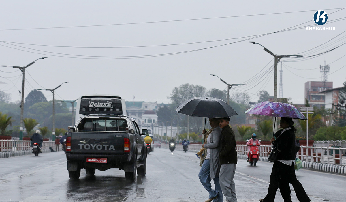
Climate and weather expert Ujjwal Upadhyay has also said the current projections should be taken seriously, but there is no need to panic.
Although most available models show concerning conditions from September 24 to 27, he said the possibility that the system could weaken before reaching Nepal cannot be ruled out. He noted that there have been previous instances in which systems that appeared strong weakened before entering Nepal.
His message is essentially to remain calm while staying alert and exercising maximum caution.
Meteorologist Binod Pokharel has also said the purpose of the projections currently being made public is not to create fear but to provide sufficient time for preparations against potential risks.
What should be done?
The Department of Hydrology and Meteorology is continuously monitoring the system. Its impact on Nepal will become clearer as its condition and direction change. Therefore, it is important to rely on official bulletins from the department and information from local authorities rather than definitive claims circulating on social media.
People planning long-distance travel, particularly in hilly and mountainous areas, on September 24, 25 and 26, should check weather and road conditions beforehand. It will be important to stay away from vulnerable riverbanks, landslide-prone slopes and weak structures and to follow instructions issued by local authorities.
In areas affected by the Bhotekoshi flood, the condition of rescue and rehabilitation infrastructure, temporary shelters, roads and bridges should be assessed before the potential rainfall. If families living in vulnerable areas need to be moved to safer locations before the rainfall, local authorities should act without delay.
The important point
Current forecasts indicate the possibility of heavy rainfall, but they do not confirm that a major disaster will occur. Signals of extreme rainfall in some models are important for preparedness, but they should not be treated as a final forecast.
At the same time, the system is developing rapidly in India. Current projections indicate that it could develop into a depression and then a deep depression on September 21-22 before reaching near southern Odisha and northern Andhra Pradesh around September 23.
Nepal’s task now is not to spread fear but to turn potential risks into timely preparedness and management. The major lesson from the Bhotekoshi disaster is that reducing risks before a disaster occurs is more important than waiting to respond after it happens.
The system’s direction and strength will become clearer over the coming days. Therefore, the period from Ashoj 8 to 12 should be treated as a period of heightened weather vigilance in Nepal. However, drawing conclusions about specific damage at this stage would not be scientifically justified.






Comment