




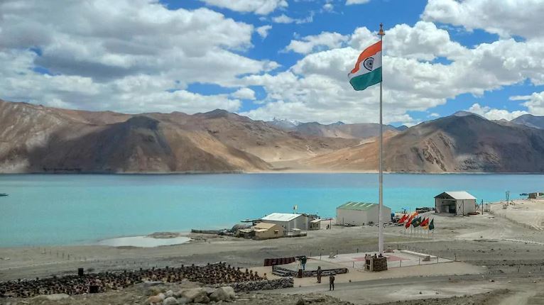
By formally naming 28 geographical features in Ladakh, including locations in Aksai Chin and friction points from the 2020 standoff, India is turning its territorial claims into permanent official records – a clear message to Beijing that New Delhi will not allow the disputed areas to be normalised as Chinese territory.
India’s decision to standardise and officially name 28 geographical features in Ladakh is more than an exercise in cartographic housekeeping. It is a carefully calibrated assertion of sovereignty at a time when China continues to contest India’s territorial claims and uses maps, place names and administrative nomenclature as instruments of state policy.
Coming within months of a similar exercise in Arunachal Pradesh, the Ladakh initiative indicates that New Delhi is increasingly prepared to respond to what it regards as China’s “cartographic aggression” in kind.
The significance of the move lies not merely in the number of places identified, but in where some of them are located. The list includes geographical features in areas claimed by India but controlled by China, including parts of Aksai Chin, as well as locations associated with the prolonged military confrontation along the Line of Actual Control (LAC).
By putting these names on the official Survey of India map, the government is effectively creating a permanent administrative and cartographic record of India’s territorial position. The message to Beijing is unmistakable: control on the ground does not translate into acceptance of sovereignty.
From cartography to strategic signalling
China has for years used place names to reinforce its territorial claims, particularly in Arunachal Pradesh. Beijing has repeatedly announced Chinese names for locations there, describing the Indian state as part of “Zangnan” or Southern Tibet.
India has consistently rejected these claims, arguing that changing names cannot alter sovereignty.
The latest exercise in Ladakh takes that argument a step further. Instead of merely rejecting Chinese nomenclature through diplomatic statements, India is institutionalising its own nomenclature through official maps and records.
The Home Ministry said the exercise was intended to remove “any ambiguity or misplaced perception” regarding land areas, peaks, mountains, passes, glaciers and water bodies in Ladakh, including those bordering Chinese-occupied Tibet, and to facilitate their “accurate recognition and better awareness among the people at large”.
That language is significant. The exercise is aimed not only at China but also at establishing an unambiguous Indian administrative narrative for government agencies, researchers, cartographers and the public.
In a territorial dispute where maps have increasingly become instruments of political messaging, the map itself becomes a statement of sovereignty.
Why Gogra and Hot Springs matter
The inclusion of Gogra and Hot Springs gives the exercise an added strategic dimension.
Both locations became major friction points during the 2020 India-China military confrontation in eastern Ladakh. Following the Galwan Valley clash, Chinese and Indian troops remained deployed in close proximity at several points, with the confrontation extending across areas including Gogra, Hot Springs, Pangong Tso and the Galwan Valley.
Subsequent disengagement agreements reduced the immediate risk of confrontation. Temporary structures were dismantled and buffer arrangements were created at several friction points.
But disengagement did not resolve the larger boundary dispute.
The Aksai Chin message
The more consequential element, however, may be the inclusion of geographical features in areas of Aksai Chin.
China has exercised physical control over Aksai Chin since the 1950s and regards it as part of its Xinjiang and Tibet regions. India continues to claim the area as part of Ladakh.
The 1963 China-Pakistan boundary agreement further complicated the territorial picture, with Pakistan ceding territory in the region to China – an arrangement India does not recognise.
By assigning standard Indian names to geographical features in such areas, New Delhi is making clear that Chinese physical control does not constitute Indian acceptance of Chinese sovereignty.
This is particularly relevant because Beijing does not recognise the Union Territory of Ladakh and has repeatedly objected to India’s administrative changes there.
India’s response is essentially to reinforce the opposite proposition: Ladakh is an integral part of India, and its territorial boundaries are not subject to unilateral reinterpretation by another country.
The 2020 confrontation remains the backdrop
The timing also matters because the legacy of the 2020 crisis remains unresolved.
In May that year, Chinese troops moved into several areas along the LAC in eastern Ladakh, leading to the most serious military confrontation between the two countries in decades. The Galwan Valley clash in June 2020, which resulted in casualties on both sides, transformed the relationship.
Disengagement has subsequently taken place at several friction points, but the military confrontation exposed a deeper problem: India and China do not have an agreed understanding of the LAC at several locations.
The creation of buffer zones after disengagement has itself generated debate in India.
Military veterans and strategic analysts have argued that while such arrangements reduce the immediate possibility of clashes, restrictions on patrolling within India’s previously asserted lines can carry a longer-term risk if temporary arrangements gradually become accepted as the new normal.
The concern is straightforward: if troops cannot patrol an area for an extended period, the absence of physical presence could eventually weaken India’s ability to enforce its claim on the ground.
Against this backdrop, the cartographic exercise acquires additional importance.
This distinction is important. A reduction in troop contact is not the same as restoration of the pre-April 2020 status quo.
That is precisely why the formal identification of Gogra and Hot Springs on India’s official map carries significance beyond nomenclature. It keeps these locations firmly within India’s territorial narrative even as military arrangements on the ground have changed.
Holding the line on paper
India’s approach appears to be based on a simple proposition: where military presence cannot continuously reinforce a territorial claim, official administrative and cartographic records can ensure that the claim itself is not diluted.
Maps cannot change the balance of forces on the ground. Nor can naming a peak or valley alter control over territory.
But maps have a different function. They establish the state’s formal position, preserve territorial claims across generations and provide a common reference for government agencies and the public.
This is precisely why China has invested so heavily in renaming places in Arunachal Pradesh. Beijing understands that territorial disputes are fought not only through deployments and negotiations but also through narratives, maps and administrative terminology.
India’s decision to standardise names in both Arunachal Pradesh and Ladakh suggests that New Delhi has recognised the same reality.
The message is therefore broader than “these places belong to India.”
It is also a warning against allowing China’s repeated renaming exercises to gradually create an impression of settled Chinese sovereignty.
For Beijing, the Indian exercise will likely be dismissed as unilateral and meaningless. But that misses the larger point. India is not trying to change Chinese control through nomenclature; it is ensuring that Chinese control does not become accepted as Chinese sovereignty.
After the military crisis of 2020, that distinction has become increasingly important.
The 28 Ladakh names, therefore, are best understood not as a symbolic list but as another layer of India’s long-term strategy on the border, maintaining the territorial claim on the map even while the military and diplomatic contest over the ground remains unresolved.





Comment