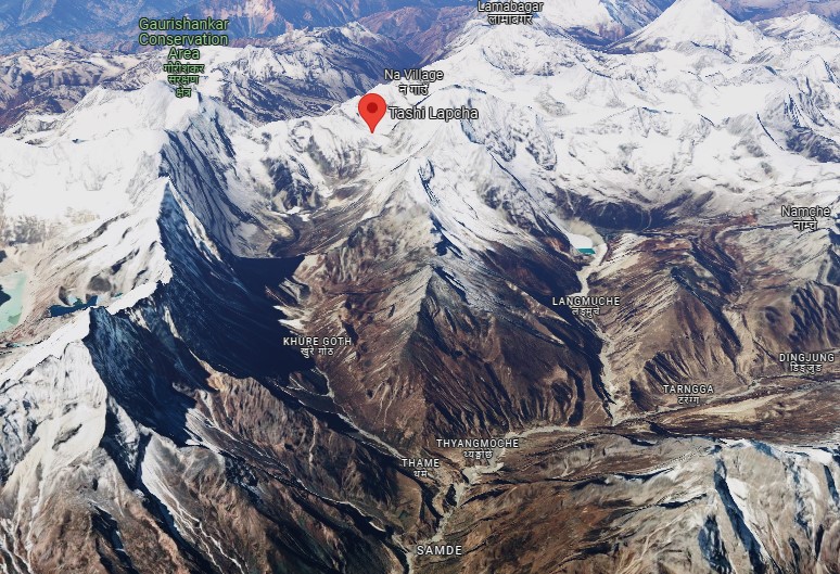
KATHMANDU: The flood that devastated the Thame coastal area in Khumbu Pasang Lhamu Rural Municipality-5 of Solukhumbu in Nepal is believed to have been triggered by rapid snowmelt.
The watershed area extending from the 6,938-meter-high Tengi Ragi Tau to the Tashi Lapcha region experienced landslides and flooding due to accelerated snowmelt.
The flood also swept away some of the three permafrost formations on the east side of Tashi Lapcha.
Permafrost is a mixture of sand and snow that has been frozen for years at temperatures below zero degrees Celsius.
The catchment area for the coastal settlement near Thame Gumba stretches from Tengi Ragi Tau through Tashi Lapcha to Kongde Ri.
In the upper region of Thame, several lakes have formed due to glacier dams.
A significant amount of snow is also present in the mountains on the northeast side of the Gaurishankar Conservation Area.
Thengpo, where the restaurant is situated, lies above Kharka Thame, which is home to numerous residential and agricultural structures.
Further downstream from Thengpo Kharka, various huts are found along the riverbank, and human activity is evident in the Khore Goth area, slightly lower down.

The Thame area, which sustained the most damage, was heavily affected by the flood, submerging many residential and tourism-related structures.
Geologist Shrikamal Dwivedi observed that footage of the Thame flood showed significant sediment flow, indicating that the rapid melting of ice and snow above the lake may have contributed to the disaster.
Dwivedi noted that the flood likely grew in magnitude after the lake was washed away.
“This disaster is linked to global temperature rise,” Dwivedi explained. “The heat accelerates snowmelt, and the increasing temperatures are a key factor in causing such floods.”


Comment