




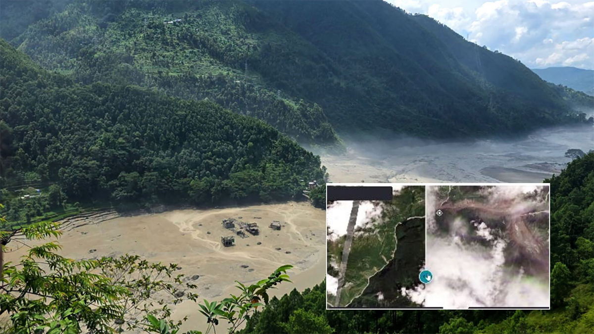
KATHMANDU: A preliminary study by the National Disaster Risk Reduction and Management Authority (NDRRMA) has identified a massive ice-rock landslide near the Nepal-China border as a possible trigger for Wednesday’s devastating flood in the Bhote Koshi River.
According to NDRRMA, analysis of satellite imagery from Planet Labs indicates that an ice-rock landslide occurred around 20 kilometres northeast of the Rasuwagadhi border point, on the Nepal-China border. The landslide appears to have sent a large volume of debris and water into the Lhende Khola, which flows into the Bhote Koshi River.
The authority said the debris-laden flood then moved through Timure before entering the Trishuli River, causing widespread destruction along the river system.
Satellite images from August 25 and 26 reportedly show the landslide and the subsequent flood in the Lhende Khola area.
Earlier, several possible explanations had emerged for the sudden flooding, including an avalanche, a glacial lake outburst or the collapse of part of a glacier. China’s government weather agency, meanwhile, had attributed the flash flood and debris flow in northern Nepal to rainfall in southern Tibet and the upper catchment area.
However, NDRRMA’s preliminary analysis based on Planet Labs satellite imagery points to the ice-rock landslide near the border as a key factor behind the flooding in the Lhende Khola.
The findings suggest that rainfall, combined with the landslide and the resulting debris flow, may have contributed to the scale of the disaster. However, NDRRMA has stressed that the findings are preliminary, and a detailed geological and hydrological assessment will be needed to establish the full cause.
The flood has caused extensive damage in Timure, Syafrubesi, Mailung and other areas of Rasuwa. As the floodwaters travelled downstream through the Trishuli River, authorities have urged communities and settlements along the river to remain on high alert.




Comment