
KATHMANDU: A catastrophic flood that swept through Lhende Khola in Nepal’s Rasuwa district on Tuesday, July 8, has been traced to a sudden glacial lake outburst in Tibet’s Pyurepu Glacier region, according to new satellite-based evidence.
The European Union’s Sentinel-2 satellite imagery, analyzed alongside data from open-source platform Zoom.Earth and a joint scientific report, has provided a clear timeline of the events leading to the disaster and confirmed that the trigger was a rapidly formed and ruptured supraglacial lake.
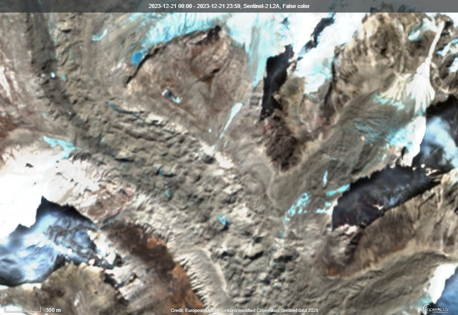
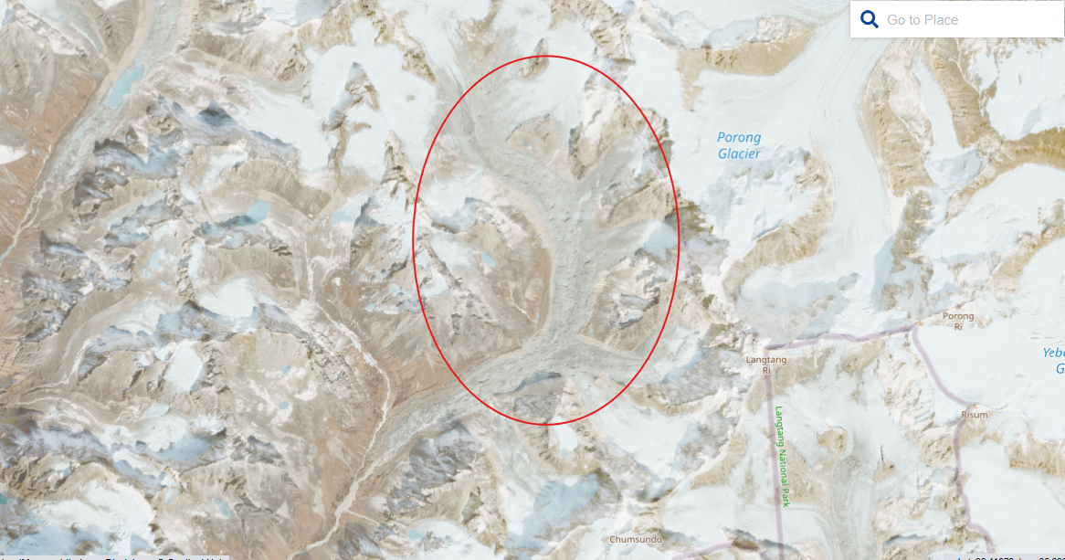
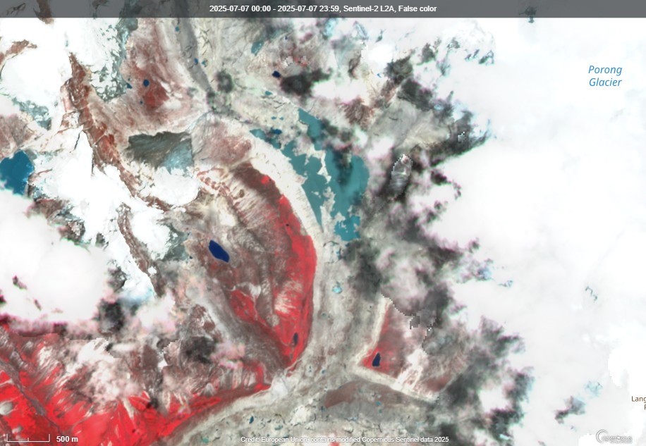
The sequence began months earlier. On December 21, 2023, satellite images first showed the presence of small meltwater ponds atop the Pyurepu Glacier, located approximately 5,100 meters above sea level and about 35 kilometers north of the Nepal-China border.
From March 2025 onward, these ponds expanded due to rising temperatures and melting permafrost, attributed to ongoing climatic shifts in the region. By late June, these growing surface ponds had coalesced into a sizeable lake. On June 28, its area was estimated at around 525,000 square meters.
Despite the growing risk, no significant surface lake was visible in Sentinel-2 images as of July 2, when the glacier remained covered in snow and glacial debris. The following day, on July 3, thick cloud cover obscured the region.
On July 4, however, at least four hours of moderate rainfall fell over the glacier, according to Zoom.Earth’s satellite weather data. That rainfall led to noticeable changes in the glacier’s surface.
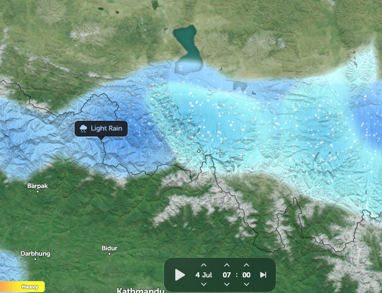
The small ponds visible since December appeared to vanish—likely absorbed into the warming ground, leaving only scattered debris visible at the surface.
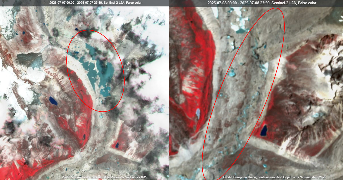
By July 5, a significant supraglacial lake had formed atop the Pyurepu Glacier. It persisted with little variation over the next two days, remaining intact through July 6 and 7.
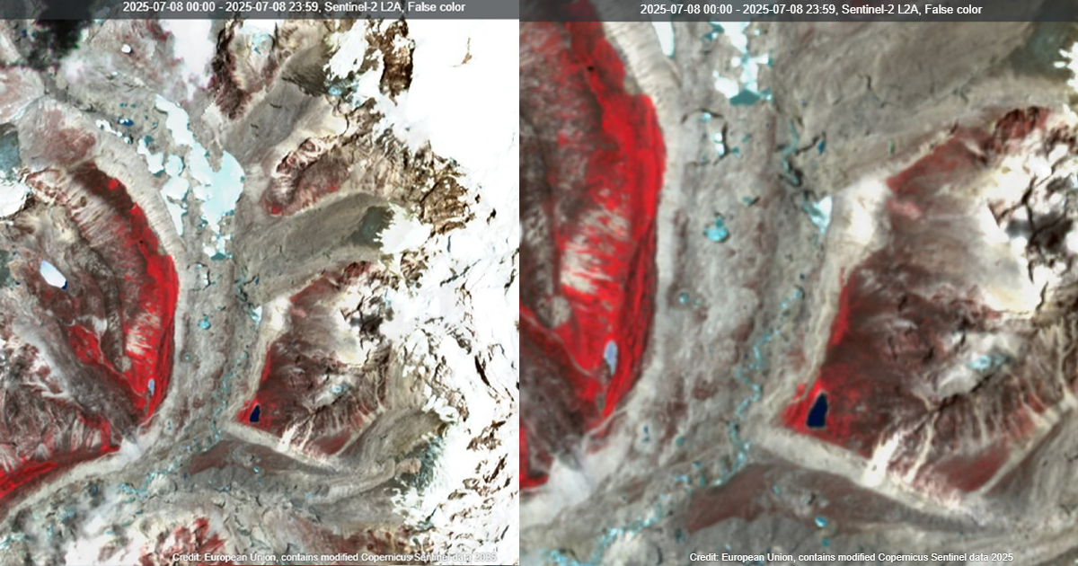
Then, on July 8, the lake disappeared from satellite view. In its place, vast amounts of water were observed flowing downslope, confirming that the lake had burst.
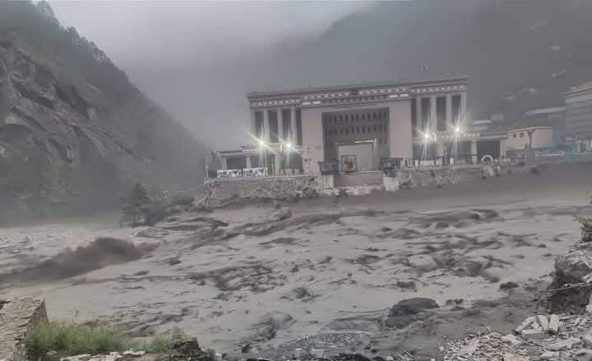
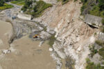
The resulting outburst triggered a large flood that surged through Lhende Khola, a tributary of the Trishuli River, causing extensive destruction downstream in Nepal.
The force of the flood washed away the Rasuwagadhi Friendship Bridge connecting Nepal and China and severely damaged the dry port at Timure, sweeping away goods and vehicles valued at over one billion rupees. More than half a dozen hydropower projects operating along the Lhende and Trishuli river basins also suffered major damage.
According to government officials, nine people have been confirmed dead and 19 remain missing. Emergency services continue search and rescue efforts in the affected areas.
A rapid hazard assessment published by the Institute of Mountain Hazards and Environment (IMHE), the University of Alaska Fairbanks, and Highrisk.org confirms that the lake atop the Pyurepu Glacier drained within a single day.
The joint report states that the lake had gradually formed from March 2025, increasing in size until it reached a maximum of 638,000 square meters on July 7. By July 8, following the rupture, the lake had shrunk to 435,000 square meters.
Visible drainage channels and fresh deposits of sediment and debris along the 35-kilometer stretch between the glacier and Nepal’s border confirmed a massive water release.
The report also confirms that the lake had formed in the middle section of the glacier’s surface. Observations point to an accumulation of new glacial debris and sediment along the flood path, which further illustrates the scale and intensity of the event.
Researchers involved in the study have attributed the outburst to climate change. Rising temperatures over recent decades have accelerated glacial melt in the Pyurepu region and contributed to the formation of unstable supraglacial ponds.
Amrit Thapa, a former analyst at the International Centre for Integrated Mountain Development (ICIMOD) and a contributor to the study, noted that these ponds, once thought to remain small and isolated, are now increasingly merging into large lakes at the glacier’s surface—a process that is occurring faster than earlier scientific projections had anticipated.
The report stresses that the area lacks any early warning system capable of detecting such glacial risks. While researchers had long flagged the potential for larger lake formation atop Himalayan glaciers, the Pyurepu event shows how swiftly these transformations can occur under current climate conditions.
It remains unclear whether the flood was caused solely by the rupture of the supraglacial lake or if additional glacial features—such as lower ice masses or other hidden lakes—also failed during the night. Cloud cover over the lower glacier on July 8 has so far prevented detailed analysis of the full scope of the collapse.
Despite the scientific clarity provided by satellite data and expert assessments, Nepal’s government has yet to issue an official statement explaining the cause of the flood. As communities reel from the disaster and authorities scramble to assess damages, the incident underscores the urgent need for cross-border glacier monitoring and real-time hazard warning systems in the vulnerable Himalayan region.


Comment