
KATHMANDU: With China trying to gain a strategic foothold in Nepal taking advantage of all debilities here, the government of Nepal, too, seems pathetic to counter the Chinese “aggression” – the latest being the unilateral measurement of Mt Everest and border encroachment in Humla.
China has been repeatedly playing against the sentiments of the Nepali people. And the re-measurement of Sagarmatha, Nepal’s dignity, is one — to name a few.
In fact, the border encroachment and construction of illegal buildings in the Nepali land is one of China’s latest domineering gestures which has triggered anti-China protests on social media with hashtags such as “Go-Back China”, “Back-Off China,” “Down with Chinese Imperialism”, etc., with street protests as its spill-over effect.
“This is not a new phenomenon,” says foreign affairs analyst Arun Kumar Subedi referring to the Chinese encroachment and arbitrary attitude against Nepal.
Apart from the encroachment in Humla, China has also made its dominant presence felt in Nepal by unilaterally measuring the height of Mt Everest (Sagarmatha), hurting the sentiments of the Nepalis once again.
As a result, Nepali people are apprehensive about China as the Communist country has been repeatedly trying to gain its strategic foothold, which are too obvious.
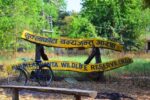
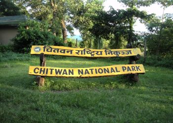
Of late, serious concerns have been raised regarding China’s encroachment of land in Humla and its suspicious move to re-measure the height of Mt Everest at a time when mountaineering expeditions have been halted amid the coronavirus pandemic.
China’s claim over Mt. Everest was an issue of ‘emotional explosion’ during that period. Nepali Congress and the Gorkha Parishad agitated against the Chinese claims in Kathmandu.
What could be the reason for the re-measurement when the world has accepted that the height of Mt Everest is 8,848 meters since 1955?
This move has generated skepticism on the height of the world’s highest peak. Some photos, too, have been publicized.
As described in the photo, China Mobile and Huawei Company have built a base station for 5G Internet on the Tibetan side of Sagarmatha, keeping the Government of Nepal in the dark about it.
It has also been claimed that after the construction of the base station, the Chinese 5G Network will cover the peak of Sagarmatha.
China’s Xinhua news agency has also confirmed that China has measured the height of Sagarmatha.
Meanwhile, more than debating on whether Sagarmatha lies in Nepal or not, border expert Buddhi Narayan Shrestha is surprised to note that the Chinese side has started measuring Sagarmatha unilaterally.
It may be recalled that Nepal had used a GPS receiver to measure the height of Sagarmatha from May 22, 2019.
“To recall, Chinese representatives had attended a two-day preparatory workshop that Nepal’s Department of Survey had organized in Kathmandu. Hence, China is well informed about the fact that Nepal is measuring the height of the highest peak of the world,” Shrestha said, adding, “Now as China is taking the measurement, it’s unusual,” Shrestha lamented.
In 1975, China had said that the height of Mt Everest is 8,848.13 meters and it was accepted as the authentic height of this peak.
However, in 2005, China claimed that the latest measurement of Sagarmatha showed its height to be 8,844.43 meters, which, however, did not get a universal validity.
Nepal has also refused to accept it as authentic and formed a group to take the measurement again.
Such a move is likely to create more complications, observers say.
Hinting at the prospective controversy the different data may invite, expert Shrestha asks, “What will happen if China claims that the height of Sagarmatha declined again?”
Since Nepali public sentiment is deeply attached to the glory of Mt. Everest, any such steps are sure to hurt their emotions, observers note.
Meanwhile, Subedi terms China’s unilateral measurement of Mt Everest as a blatant violation of the 1963 protocol that Nepal and China had signed.
During the then Prime Minister BP Koirala’s visit to China in 1960 and the reciprocation visit by Chinese Premier Zhou Enlai, there had been a discussion on this issue incorporating it as a point of reference.
Prior to this, China had included Mahalangur Himalayan range in its map. It had then claimed that as the monk of Syangboche monastery is a Tibetan, China could claim up to it, according to Subedi.
He added that Prime Minister BP Koirala then talked to Zhou Enlai and then Chairman of Communist Party of China Mao Tse Tung on the issue and had convinced them with logics and facts supporting Nepal’s claim on Mt Everest.
After this, around 21 grazing fields, a village of Mustang and Mt. Everest were located on the Nepali side.
Soon the Koirala-led government was dismissed by King Mahendra which delayed the treaty that was otherwise at hand. It remained in narration alone, according to him.
He added that the treaty of 1961 signed during the King Mahendra’s rule has not changed much of the points of reference made during BP Koirala’s time.
What also has to be noted with emphasis is that during an interview with Kishori Raman Rana, then Editor of the Kalpana, Chinese Premier made it loud and clear that the Everest peak and the Southern part of it belong to Nepal while the northern part belongs to China.
Now, China has stated that the Sagarmatha peak and the northern part are its border point.
Subedi says that the treaties of 1960 and 1962 hail Sagarmatha and the southern part as Nepal’s, which China defies it now.
He queries, “What’s the basis of China’s aggression? Which letter of exchange or protocol allows China to do so?
As China measures the height of Sagarmatha, it has violated the 1963 Protocol which hails that any dispute on the border or other border activities has to be settled through a border survey team consisting of an equal number of representatives from both nations.
“I feel embarrassed and ashamed of the dual standards of the incumbent government as it bugles the pillars on Indian sides have been moving here and there (whereas the fact is that provided the government wants, it can easily find out the truth using GPS Coordinate used in pillars),” Subedi adds.
Likewise, he also maintained that it shows an unwillingness to request for GPS Coordinate in pillars on Chinese borders and also to request China to abide by the signed treaties.
It should also be noted that such a move from the Chinese side had triggered mass protests in Kathmandu and elsewhere on May 25, 1960, when a Chinese team climbed the summit from the northern face without the knowledge of Nepal.
The Nepal-China Joint Boundary Committee has said that Sagarmatha has been placed within the Nepalese territory as clearly and unequivocally as the Sagarmatha area on the basis of the traditional, customary borderline.
Former Foreign Minister and Nepali Congress (NC) leader Dr Prakash Sharan Mahat dubs it “irresponsible” on the part of the Nepal Communist Party-led government to keep quiet on the issue even though China has been repeatedly playing against the people’s sentiments.
“This has been clearly stated during the BP Koirala’s China visit that Sagarmatha belonged to Nepal,” he told Khabarhub. “The government of Nepal has not been pro-active on the issue, including the border encroachment in Humla,” he said.
Meanwhile, this week, NC concluded that China has encroached the Nepali land in Humla. A field report prepared by NC leader Jeewan Bahadur Shahi and his team of lawmakers says China has even moved the Pillar-12 besides constructing buildings.
To go back to June 1960 – another incident of Chinese high-handedness — some Chinese troops had killed a Nepali citizen Subedar Bam Prasad and captured ten soldiers in Nepal’s Mustang – some two kilometers within Nepal’s boundary.
After that incident, the Chinese side claimed that ‘the place of the incident was within the Chinese territory, and that the Chinese troops did not enter Nepal’s territory” sparking a series of anti-China protests in Kathmandu.
Due to Chinese continued high-handedness, anti-China protests led by the Nepali Congress party, including 18 social organizations, flared up in Kathmandu on 20 April 1960.
Following mounting pressure from Nepal, the Chinese side agreed to compensate for the killing, and agreed to return the captured Nepali prisoners.
Meanwhile, when then King Mahendra embarked on a 17-day state visit to China in September 1961, he had then said that the Nepali people would experience a sense of glory as he announced that Sagarmatha continues to be as it has been — within Nepal’s territory.
Even Nepal’s then Foreign Minister Tulsi Giri reiterated that Mt. Everest peak was in Nepal.
China’s claim over Mt. Everest was an issue of ‘emotional explosion’ during that period. Nepali Congress and the Gorkha Parishad agitated against the Chinese claims in Kathmandu.
During that time, Communist Party General Secretary Keshar Jung Rayamajhi, who was considered pro-Chinese, had categorically stated that Mt Everest was in Nepal’s possession.
He, however, changed his tone on the eve of the Chinese premier Chou En-Lai’s visit. He said China’s views also need to be considered. Similarly, other Communist leaders, including Tulasi Lal Amatya, Man Mohan Adhikari and Pushpa Lal Shrestha called for peaceful settlement of the dispute with the Chinese.
Due to Chinese continued high-handedness, anti-China protests led by the Nepali Congress party, including 18 social organizations, flared up in Kathmandu on 20 April 1960.
Undeclared blockade
Another one example of Chinese antagonism is what has been dubbed as “undeclared blockade” besides border disputes amid the coronavirus pandemic.
The border dispute between Nepal and China has not been resolved yet. The dispute ranging from Humla to north Lamabagar of Dolakha is the same.
Although Nepal has agreed with China to allow people of both the entry points for trade, China has imposed restrictions on the people’s movement.
The Tatopani and Rasuwagadhi entry points, which had remained closed unilaterally on the part of China for several months have been opened for trade recently.
There is a situation of an undeclared blockade as the border checkpoints which open for a few days will close on one pretext or the other due to which locals of the bordering places, including Jhala, Larke and Railahos of Gorkha or Olangchungola of Taplejung or Kimathanka of Sankhuwasabha and Lama Bagar of Dolakha have been suffering a lot.
China seems to be ignoring the agreements to allow locals to travel up to 20 km.
The situation is no different in Dolakha, Manang and Mugu districts as the Nepal government led by the Nepal Communist Party (NCP) has not been able to prioritize the issue of opening the border with China.
A peek into the history
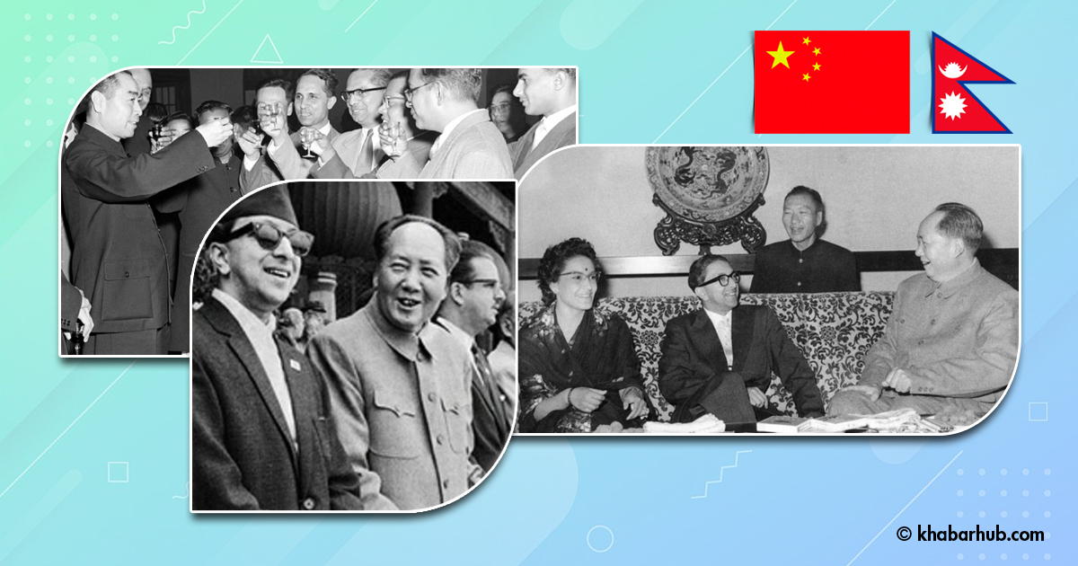
After BP Koirala came to power as Nepal’s first elected Prime Minister with a two-thirds majority in the parliament in 1959, Nepal had had a formal agreement on the dispute surrounding Mt Everest (Sagarmatha) with China.
Nepali delegates led by then Prime Minister Koirala presented Nepal’s map to the Chinese counterpart claiming that Mt Everest lies in Nepal.
It may be noted with emphasis that Koirala, in his autobiography, has categorically mentioned his discussion with Chairman Mao.
Even in his biography, he says, “Regarding the border, he (Mao) said that there is no dispute. Let’s regard Mt Everest as the common peak between the two countries, and let’s call it a Friendship Peak, but I did not agree.”
Koirala responded thus, “Mt Everest is our peak, and lies in Nepal. How can we accept it as a common peak between Nepal and China?”
Mao had then told Koirala that since Nepal didn’t even have its name in the Nepali language, and widely called it Mount Everest.
“I then remembered, or someone reminded me, that it is Sagarmatha in Nepali.”
Koirala, meanwhile, responded, “You, too, don’t have a name for the peak as well. Chomolungma is a Tibetan name.”
Mao then responded, “Tibet is China,” he said, “Ok, let’s come to a meeting point now, and keep its name a Friendship Peak, neither Chomolungma nor Sagarmatha.”
BP Koirala remained adamant about his stance on Sagarmatha. “We didn’t agree on it,” he has written in his (auto-biography) Aatmabritanta.
Even though the opinions between BP Koirala and Mao differed on the issue, they had agreed to form a joint team to determine the border between the two neighbors.
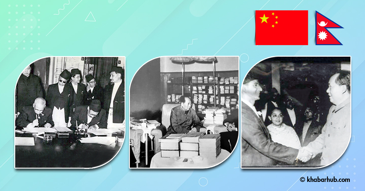
The two countries signed an agreement on the boundary between the two countries on March 21, 1960.
The treaty was signed by then Prime Minister BP Koirala and his Chinese Counterpart Zhou Enlai.
The third point of the agreement mentions that a joint team consisting of an equal number of delegates from each country will be formed to settle the conflict provided it arises between these two neighboring nations.
The treaty hails that ‘the slopes, valleys and the passes’ will be regarded as the basis for border demarcation.
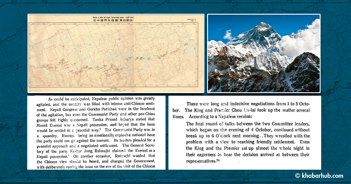
Despite the treaty, the public dislike against Chinese attitude in the Sagarmatha issue continued for quite a long time and the traces of such dislikes were smelt during Premier Zhou Enlai’s Nepal visit on April 26-29, 1960.
Here is Zhou’s response published in the Gorkhapatra daily, also published in Peking Review on May 3, 1960.
“We have never laid any territorial claim to Chomolungma (name in the Tibetan language) or Sagarmatha ever since the question was raised during the talks in Peking”.
The details of Zhou’s press conference were published in the Peking Review.
During the talks in Peking, the two sides also exchanged the maps. The delineations on the maps of the two countries are different.
The Chinese maps which were drawn on the basis of the Chinese historical situation show the mountain within Chinese territory, while the Nepalese maps which were drawn on the basis of the Nepalese historical situation show the mountain on the boundary line between the two countries.
During that time, Nepal’s Prime Minister Koirala made the point that Nepal had always regarded Mt Everest as Nepal’s.
Mao, while receiving Prime Minister Koirala, expressed the view that the two sides could follow the Nepalese delineation which shows the mountain on the boundary line, that is to say, with the northern half of the peak belonging to China and the Southern half of the peak belonging to Nepal.
“Since then, our government has maintained this attitude.”(Nepali, Chitta Ranjan, Kehi Eitihasik Nibandhaharu, Royal Nepal Academy: 2060, P 100) (Historian Chitta Ranjan Nepali was a member of Nepal China Joint Committee to settle Border Dispute)
Keeping these discussions and conflicting views in mind, the Nepal-China Joint Boundary Commission was formed in 1960.
Six people under the leadership of Major General Padma Bahadur Khatri from the Nepali side and Chen Shi Chih and his five members from the Chinese side attended the first meeting of the Commission on October 12, 1960.
This meeting prepared the draft for the Nepal-China Boundary Treaty.
Finally, during King Mahendra’s visit to China, the Nepal China Boundary Treaty was signed on October 5, 1961.
From the Chinese side, the then President Liu Shaoqi had signed the treaty.
Clause 1 (11) of the treaty has thus settled the dispute over Sagarmatha: “From Niehlu (Niule) bridge the boundary line runs generally eastward to Chejenma (Gauri Shankar), and then eastward along the mountain ridge and then northward along the watershed between the Rongshar River and the Rongbuk River on the one hand and the tributaries of the Dudh Kosi River on the other hand to Nagpa Pass, and then runs generally southeastward along the mountain ridge, passing through Cho Oyu Mountain, Pumoli Mountain (Gnire Langur), Mount Chomo-lungma (Sagarmatha) and Lhotse, to Makalu Mountain; then runs southeastward and then eastward along the mountain ridge to Popti Pass.”
This clause clearly states that the boundary line goes past Sagarmatha.
What does this mean?
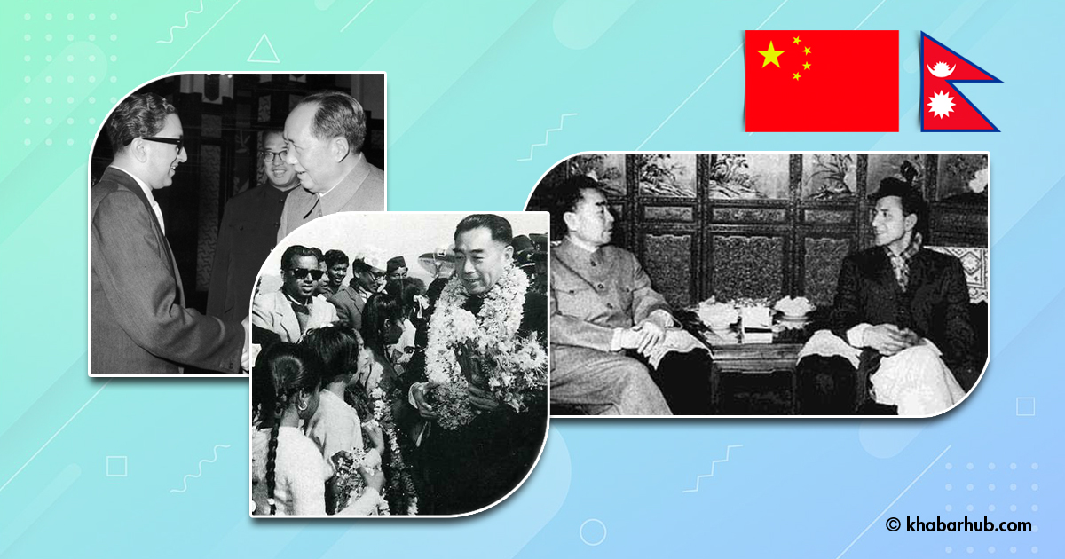
According to Buddhi Narayan Shrestha, there is a 7-feet-long and 8-feet-wide steep side at Sagarmatha peak and this lies in Nepal.
“Although climbers can climb from the Chinese side as well, unless they reach the peak, which lies on the Nepali side, the ascent is not complete,” Shrestha adds.
As Shrestha says, China does not have a different opinion about the fact that the Sagarmatha peak lies in Nepal.
That’s why after returning Nepal signing a boundary treaty with China, then King Mahendra had expressed his satisfaction in Kathmandu on November 3, 1961, saying, “We feel proud to announce that Sagarmatha, which is tempting to the entire world has been in our country as ours.” (Nepali, Chitta Ranjan, Kehi Eitihashik Nibandhaharu, Royal Nepal Academy: 2060, p 105)

Comment